Point Thomson Ice Conditions
for BP Exploration (Alaska), 2002
Historical Landsat imagery was used to map coastal ice conditions affecting operations planning for the proposed Pt. Thomson oil development east of Prudhoe Bay.
Point Hope Polynya
for AMEC Simons, Vancouver, February 2001
This project involved collecting all available Landsat imagery over the past 28 years, showing the development and extent of the recurring winter polynya along the Chukchi Sea coast between Point Hope and Cape Kruzenstern. The results were used to support ongoing environmental assessments of the proposed expansion to the DeLong Mountain Terminal serving the Red Dog mine.
Coastal Information Resource Inventory
for Ministry of Aquaculture, Fisheries and Food (subcontract to Coastal & Ocean Resources Inc.), 1993
Dickins was part of a multi-disciplinary project team conducting an inventory of the various databases related to coastal resources in British Columbia.
Environmental Conditions: Soviet Barents Sea
for an Oil Industry Client, 1991
Dickins Associates combined data from a wide variety of sources to provide a composite description of ice regimes (ice edges, concentrations, drift, and thickness) and climate in the Pechora Gulf in the Russian Barents Sea, an area of active oil development.
Review of Ocean Models: Research, Development, and Operation
for the Panel on Energy Research and Development, 1991
Dickins Associates prepared a summary of wave, current, and oil spill trajectory models, focusing on operational needs in Canada.
Historical Review of Industry Use of Offshore Staging Sites
for Environment Canada (subcontract to the Seakem Group), 1991
The company developed an historical overview of industry activities at Herschel Island and in McKinley Bay from 1976 to 1990, along with all records of contaminant spills or deliberate releases.
Kulluk Drilling Program, 1990-1992
for Gulf Canada Resources, 1990
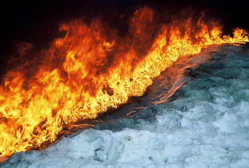
Dickins reviewed the ice information contained in the environmental submission and acted as an expert witness at the hearings of the Environmental Impact Review Board on issues related to Beaufort Sea ice conditions and oil behaviour in ice.
Environmental Summary of Stikine Hovercraft Operations
for Cominco Metals, 1990
Dickins investigated the potential impact of above surface and underwater noise on fish stock and migratory birds along the proposed hovercraft route.
Beaufort Sea Extreme Wave Study
for Environmental Studies Research Funds, 1990-1991
The company recommended different statistical approaches to account for the presence of the pack ice edge location in hind casting the worst storm events over the past 25 years.
Environmental Atlases for Beaufort Sea and Lancaster Sound Oil Spill Response
for Environment Canada, 1986 and 1989-1990
Dickins managed the projects, coordinated the production of the final atlases and completed all sections on the marine ice environment. The assessment methodology and shoreline sensitivity ranking systems continue to be used in present day interactive atlases.
Publications: Environmental Research and Offshore Engineering
Oil Spill Response Atlas for the Southwest Coast of Vancouver Island
for the B.C. Ministry of Environment, 1990
Dickins Associates directed a team of specialists to develop a comprehensive coastal sensitivity atlas of Southwest Vancouver Island.
Esso Chevron et al. Isserk I-15 Drilling Application
for Esso Resources (Canada), 1989
Dickins was contracted to assist with the preparation of an environmental summary of the proposed drilling program and to act as an expert witness on Beaufort Sea ice conditions during hearings called by the Environmental Impact Review Board.
Winter Distribution of Multi-Year Ice in the North Chukchi Sea
for Mobil Oil, 1988 (with the cooperation of the NASA Goddard Space Flight Center)
The extent of multi-year ice was mapped over an eight-year period by utilizing daily representations of the multi-year ice fraction derived from Nimbus-7 SMMR data.
Reconnaissance Aerial Survey of Ice Break-Up Processes in the Canadian Beaufort Sea Coastal Zone
for the Bedford Institute of Oceanography, 1987
A 22 day field program documented specific features of nearshore ice, which play a role in coastal sediment transport and nearshore ice gouging in the Beaufort Sea.
Pack Ice in Canadian Waters
for Environment Canada, 1986
The pack ice regimes in the Beaufort Sea, Lancaster Sound, and offshore Labrador were evaluated according to dynamic processes affecting oil behaviour in a moving ice environment. Statistical summaries of lead and floe dynamics are presented according to location and time of year. Data sources included aerial photography, SLAR imagery and Landsat imagery.
Publications: Environmental Research and Offshore Engineering
Alaskan Beaufort Sea Ice Atlas
for SOHIO Petroleum Company, 1984 (now BP Exploration)
This full color atlas maps the occurrence of critical parameters of the offshore environment for planning future exploration and production activities.
Multi-Year Ice Thickness Distribution in the Beaufort Sea
for Gulf Canada Resources Inc., 1982
Fourteen floes were surveyed at the polar pack edge in April 1982. A comprehensive set of statistics were obtained through drill hole measurements and sonar profiling. This data set is one of a very limited number of studies, which provide a reliable distribution of multi-year floe thickness with ridges deliberately excluded.
Publications: Environmental Research and Offshore Engineering